
Öland topographic map
Interactive map
Click on the map to display elevation.
About this map
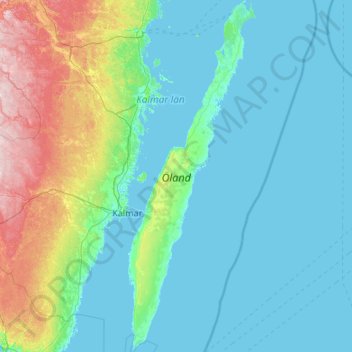
Name: Öland topographic map, elevation, terrain.
Location: Öland, Borgholm, Kalmar County, Region Götaland, Sweden (56.19450 16.36922 57.36882 17.15064)
Average elevation: 31 m
Minimum elevation: -2 m
Maximum elevation: 219 m
Other topographic maps
Click on a map to view its topography, its elevation and its terrain.