
Thank you for supporting this site ❤️
Make a donation
Make a donation
Flemish Brabant topographic map
Click on the map to display elevation.
Thank you for supporting this site ❤️
Make a donation
Make a donation
About this map
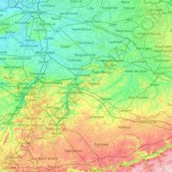
Name: Flemish Brabant topographic map, elevation, terrain.
Location: Flemish Brabant, Flanders, Belgium (50.68738 3.88932 51.04982 5.18803)
Average elevation: 71 m
Minimum elevation: -3 m
Maximum elevation: 303 m
Thank you for supporting this site ❤️
Make a donation
Make a donation
Other topographic maps
Click on a map to view its topography, its elevation and its terrain.