
Ogbadibo topographic map
Interactive map
Click on the map to display elevation.
About this map
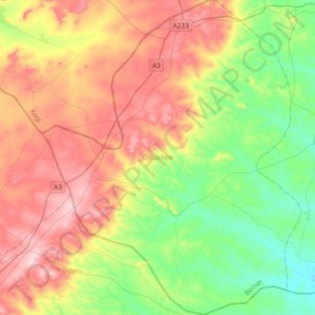
Name: Ogbadibo topographic map, elevation, terrain.
Location: Ogbadibo, Benue, Nigeria (6.85182 7.53051 7.16489 7.79004)
Average elevation: 295 m
Minimum elevation: 122 m
Maximum elevation: 535 m
Other topographic maps
Click on a map to view its topography, its elevation and its terrain.