
Ciénaga de Ayapel topographic map
Interactive map
Click on the map to display elevation.
About this map
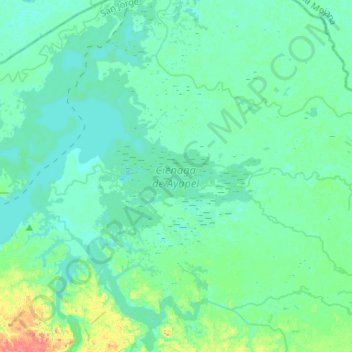
Name: Ciénaga de Ayapel topographic map, elevation, terrain.
Location: Ciénaga de Ayapel, San Jorge, Córdoba, RAP Caribe, Colombia (8.20680 -75.15469 8.46640 -74.96908)
Average elevation: 23 m
Minimum elevation: 14 m
Maximum elevation: 68 m
Other topographic maps
Click on a map to view its topography, its elevation and its terrain.