
Thank you for supporting this site ❤️
Make a donation
Make a donation
Mont Dore topographic map
Click on the map to display elevation.
Thank you for supporting this site ❤️
Make a donation
Make a donation
About this map
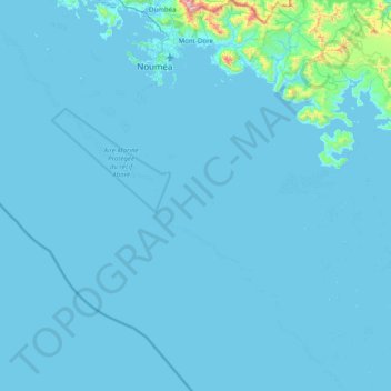
Name: Mont Dore topographic map, elevation, terrain.
Location: Mont Dore, South Province, New Caledonia, France (-22.88171 166.47990 -22.15178 166.97892)
Average elevation: 29 m
Minimum elevation: -2 m
Maximum elevation: 1,051 m
Thank you for supporting this site ❤️
Make a donation
Make a donation
Other topographic maps
Click on a map to view its topography, its elevation and its terrain.