
Thank you for supporting this site ❤️
Make a donation
Make a donation
Cualedro topographic map
Click on the map to display elevation.
Thank you for supporting this site ❤️
Make a donation
Make a donation
Cualedro
Cualedro is a municipality in the province of Ourense, in the autonomous community of Galicia, Spain. It belongs to the comarca of Verín. Its population was 1,792 in 2016. The municipality has an area of 117.6 km. The elevation level is 843 meters.
Thank you for supporting this site ❤️
Make a donation
Make a donation
About this map
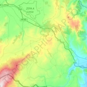
Name: Cualedro topographic map, elevation, terrain.
Location: Cualedro, Verín, Ourense, Galicia, Spain (41.87940 -7.70414 42.07379 -7.50554)
Average elevation: 705 m
Minimum elevation: 367 m
Maximum elevation: 1,420 m
Thank you for supporting this site ❤️
Make a donation
Make a donation
Other topographic maps
Click on a map to view its topography, its elevation and its terrain.