
Thank you for supporting this site ❤️
Make a donation
Make a donation
New Franklin topographic map
Click on the map to display elevation.
Thank you for supporting this site ❤️
Make a donation
Make a donation
About this map
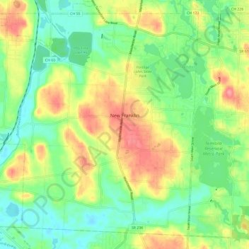
Name: New Franklin topographic map, elevation, terrain.
Location: New Franklin, Summit County, Ohio, 44216, United States (40.91032 -81.64773 40.98869 -81.53159)
Average elevation: 316 m
Minimum elevation: 283 m
Maximum elevation: 365 m
Thank you for supporting this site ❤️
Make a donation
Make a donation