
Thank you for supporting this site ❤️
Make a donation
Make a donation
Mayumba topographic map
Click on the map to display elevation.
Thank you for supporting this site ❤️
Make a donation
Make a donation
About this map
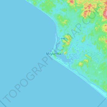
Name: Mayumba topographic map, elevation, terrain.
Location: Mayumba, Nyanga Province, Gabon (-3.59105 10.49437 -3.27105 10.81437)
Average elevation: 12 m
Minimum elevation: -3 m
Maximum elevation: 225 m
Thank you for supporting this site ❤️
Make a donation
Make a donation