
Dublin topographic map
Click on the map to display elevation.
About this map
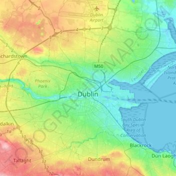
Name: Dublin topographic map, elevation, terrain.
Location: Dublin, County Dublin, Leinster, Ireland (53.29873 -6.38703 53.41054 -6.11488)
Average elevation: 42 m
Minimum elevation: -2 m
Maximum elevation: 131 m