
Wesley Chapel topographic map
Click on the map to display elevation.
Wesley Chapel
According to the United States Census Bureau, the CDP has a total area of 6.1 square miles (16 km2), of which 6.1 square miles (16 km2) is land and 0.04 square miles (0.10 km2) (0.49%) is water. The elevation is about 100 feet (30 m), combined with an inland location, creates more temperature variation in the humid subtropical climate.
About this map
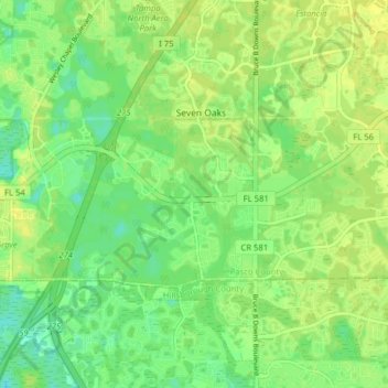
Name: Wesley Chapel topographic map, elevation, terrain.
Location: Wesley Chapel, Pasco County, Florida, United States (28.16993 -82.40338 28.20310 -82.32457)
Average elevation: 19 m
Minimum elevation: 9 m
Maximum elevation: 26 m