
Thank you for supporting this site ❤️
Make a donation
Make a donation
Bad Lobenstein topographic map
Click on the map to display elevation.
Thank you for supporting this site ❤️
Make a donation
Make a donation
About this map
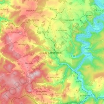
Name: Bad Lobenstein topographic map, elevation, terrain.
Location: Bad Lobenstein, Saale-Orla-Kreis, Thuringia, 07356, Germany (50.40596 11.55394 50.49391 11.73349)
Average elevation: 560 m
Minimum elevation: 395 m
Maximum elevation: 735 m
Thank you for supporting this site ❤️
Make a donation
Make a donation