
Thank you for supporting this site ❤️
Make a donation
Make a donation
Beira topographic map
Click on the map to display elevation.
Thank you for supporting this site ❤️
Make a donation
Make a donation
About this map
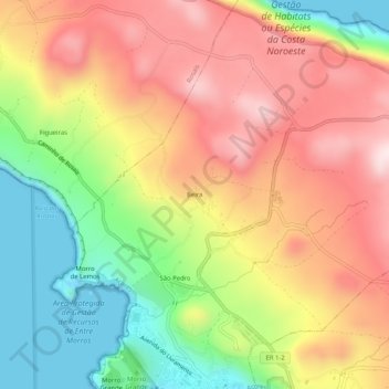
Name: Beira topographic map, elevation, terrain.
Location: Beira, Velas (São Jorge), Velas, Azores, 9800-501, Portugal (38.68098 -28.23032 38.72098 -28.19032)
Average elevation: 258 m
Minimum elevation: -6 m
Maximum elevation: 501 m
Thank you for supporting this site ❤️
Make a donation
Make a donation
Other topographic maps
Click on a map to view its topography, its elevation and its terrain.