
Saint-Rhémy-en-Bosses topographic map
Interactive map
Click on the map to display elevation.
About this map
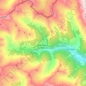
Name: Saint-Rhémy-en-Bosses topographic map, elevation, terrain.
Location: Saint-Rhémy-en-Bosses, Aosta Valley, Italy (45.77619 7.07695 45.87927 7.20189)
Average elevation: 2,181 m
Minimum elevation: 1,137 m
Maximum elevation: 3,292 m