
Heerde topographic map
Interactive map
Click on the map to display elevation.
About this map
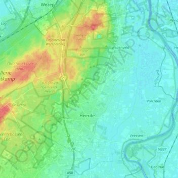
Name: Heerde topographic map, elevation, terrain.
Location: Heerde, Gelderland, Netherlands (52.35651 5.95100 52.45481 6.13055)
Average elevation: 14 m
Minimum elevation: -4 m
Maximum elevation: 54 m
Dutch Topographic map of the municipality of Heerde, June 2015.