
Adeje topographic map
Interactive map
Click on the map to display elevation.
About this map
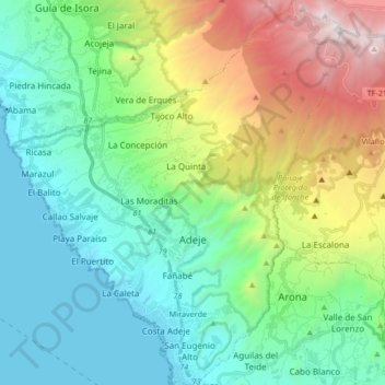
Name: Adeje topographic map, elevation, terrain.
Location: Adeje, Santa Cruz de Tenerife, Canary Islands, Spain (28.06591 -16.80217 28.21298 -16.66005)
Average elevation: 703 m
Minimum elevation: 0 m
Maximum elevation: 2,514 m