
Angoulême topographic map
Click on the map to display elevation.
Angoulême
The earliest Cretaceous period - the Cenomanian- is in the relatively low areas (l'Houmeau, the heights of Saint-Cybard, Sillac), at an average altitude of 50m.
About this map
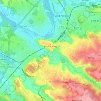
Name: Angoulême topographic map, elevation, terrain.
Average elevation: 72 m
Minimum elevation: 27 m
Maximum elevation: 150 m