Geolocate
👉 Easily get elevation data in JSON, GeoTIFF and KML formats using Elevation API
Thank you for supporting this site ❤️
Make a donation

Ilesa topographic map

Click on the map to display elevation.

👉 Easily get elevation data in JSON, GeoTIFF and KML formats using Elevation API
Thank you for supporting this site ❤️
Make a donation

About this map

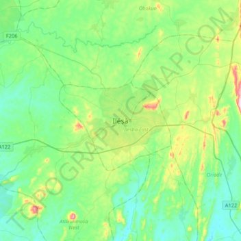
Name: Ilesa topographic map, elevation, terrain.

Location: Ilesa, Ilesha West, Osun State, Nigeria (7.46459 4.58147 7.78459 4.90147)

Average elevation: 354 m

Minimum elevation: 250 m

Maximum elevation: 692 m