
Thank you for supporting this site ❤️
Make a donation
Make a donation
Carlsgrün topographic map
Click on the map to display elevation.
Thank you for supporting this site ❤️
Make a donation
Make a donation
About this map
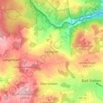
Name: Carlsgrün topographic map, elevation, terrain.
Location: Carlsgrün, Bad Steben, Landkreis Hof, Bavaria, 95138, Germany (50.35740 11.59941 50.39740 11.63941)
Average elevation: 612 m
Minimum elevation: 490 m
Maximum elevation: 703 m
Thank you for supporting this site ❤️
Make a donation
Make a donation