
Akko topographic map
Interactive map
Click on the map to display elevation.
About this map
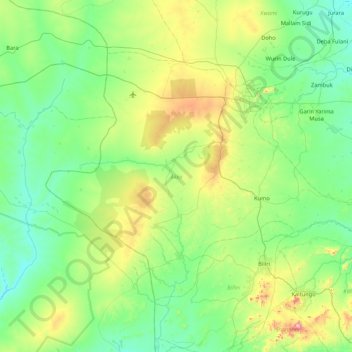
Name: Akko topographic map, elevation, terrain.
Location: Akko, Gombe State, 760251, Nigeria (9.80540 10.68451 10.39893 11.53943)
Average elevation: 416 m
Minimum elevation: 230 m
Maximum elevation: 1,095 m
Other topographic maps
Click on a map to view its topography, its elevation and its terrain.