
Tervuren topographic map
Interactive map
Click on the map to display elevation.
About this map
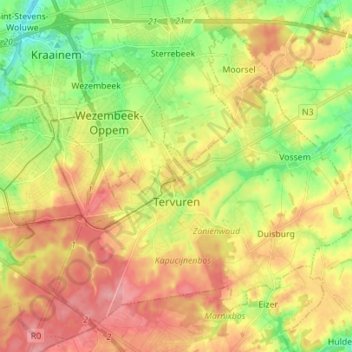
Name: Tervuren topographic map, elevation, terrain.
Location: Tervuren, Leuven, Flemish Brabant, Flanders, 3080, Belgium (50.79381 4.44718 50.86746 4.58642)
Average elevation: 82 m
Minimum elevation: 31 m
Maximum elevation: 133 m