
Thaton District topographic map
Interactive map
Click on the map to display elevation.
About this map
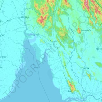
Name: Thaton District topographic map, elevation, terrain.
Location: Thaton District, Mon, 100, Myanmar (16.48466 96.86890 17.71763 97.64850)
Average elevation: 55 m
Minimum elevation: -2 m
Maximum elevation: 1,350 m