
Miyagi Prefecture topographic map
Interactive map
Click on the map to display elevation.
About this map
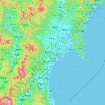
Name: Miyagi Prefecture topographic map, elevation, terrain.
Location: Miyagi Prefecture, Japan (37.77325 140.27487 39.00278 142.05136)
Average elevation: 207 m
Minimum elevation: -3 m
Maximum elevation: 2,021 m