
Pagar Alam topographic map
Interactive map
Click on the map to display elevation.
About this map
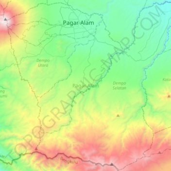
Name: Pagar Alam topographic map, elevation, terrain.
Location: Pagar Alam, South Sumatra, Indonesia (-4.26717 103.13002 -3.98478 103.41541)
Average elevation: 1,289 m
Minimum elevation: 400 m
Maximum elevation: 3,151 m
Other topographic maps
Click on a map to view its topography, its elevation and its terrain.
Kandis
Indonesia > South Sumatra > Kandis
Kandis, Ogan Ilir, South Sumatra, Indonesia
Average elevation: 11 m