
Ottawa topographic map
Interactive map
Click on the map to display elevation.
About this map
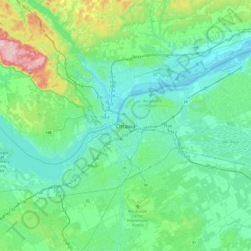
Name: Ottawa topographic map, elevation, terrain.
Location: Ottawa, Eastern Ontario, Ontario, K1P 1J1, Canada (45.26111 -75.85031 45.58111 -75.53031)
Average elevation: 99 m
Minimum elevation: 39 m
Maximum elevation: 369 m