
Rivers topographic map
Interactive map
Click on the map to display elevation.
About this map
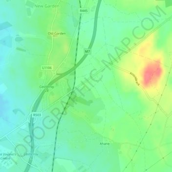
Name: Rivers topographic map, elevation, terrain.
Average elevation: 34 m
Minimum elevation: 13 m
Maximum elevation: 74 m
Other topographic maps
Click on a map to view its topography, its elevation and its terrain.
Rivers
Ireland > The Metropolitan District of Limerick City
Rivers, Ballyvarra, The Metropolitan District of Limerick City, County Limerick, Munster, V94 A431, Ireland
Average elevation: 34 m