
Jan Mayen topographic map
Interactive map
Click on the map to display elevation.
About this map
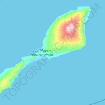
Name: Jan Mayen topographic map, elevation, terrain.
Location: Jan Mayen, 1, Norway (70.82597 -9.07717 71.16042 -7.92853)
Average elevation: 94 m
Minimum elevation: -1 m
Maximum elevation: 2,212 m