
Shanxi topographic map
Interactive map
Click on the map to display elevation.
About this map
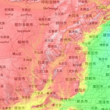
Name: Shanxi topographic map, elevation, terrain.
Location: Shanxi, China (34.58407 110.21954 40.74523 114.56551)
Average elevation: 936 m
Minimum elevation: 7 m
Maximum elevation: 2,872 m
Other topographic maps
Click on a map to view its topography, its elevation and its terrain.
Pingcheng District
China > Shanxi > Pingcheng District
Datong, Pingcheng District, Datong City, Shanxi, 037004, China
Average elevation: 1,149 m