
Mount Lincoln topographic map
Interactive map
Click on the map to display elevation.
About this map
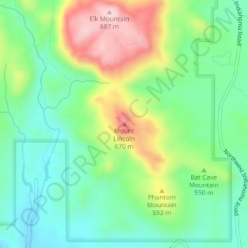
Name: Mount Lincoln topographic map, elevation, terrain.
Location: Mount Lincoln, Comanche County, Oklahoma, USA (34.71252 -98.72151 34.71262 -98.72141)
Average elevation: 532 m
Minimum elevation: 444 m
Maximum elevation: 692 m
Other topographic maps
Click on a map to view its topography, its elevation and its terrain.