
Mount Kenya topographic map
Interactive map
Click on the map to display elevation.
About this map
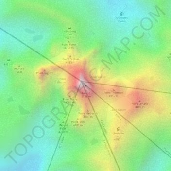
Name: Mount Kenya topographic map, elevation, terrain.
Location: Mount Kenya, Embu County, Kenya (-0.15276 37.30916 -0.15266 37.30926)
Average elevation: 4,556 m
Minimum elevation: 4,181 m
Maximum elevation: 5,149 m
Other topographic maps
Click on a map to view its topography, its elevation and its terrain.