
Karnali topographic map
Interactive map
Click on the map to display elevation.
About this map
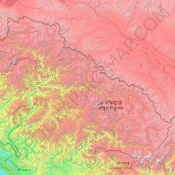
Name: Karnali topographic map, elevation, terrain.
Location: Karnali, Mid-Western Development Region, Nepal (28.72190 81.25622 30.44695 83.67995)
Average elevation: 4,062 m
Minimum elevation: 196 m
Maximum elevation: 8,008 m
Other topographic maps
Click on a map to view its topography, its elevation and its terrain.
Ghaghara River
Nepal > Mid-Western Development Region
Ghaghara River, Dailekh, Bheri, Mid-Western Development Region, 271833, Nepal
Average elevation: 1,522 m
Bheri
Nepal > Mid-Western Development Region
Bheri, Mid-Western Development Region, Nepal
Average elevation: 909 m
Dhaulagiri Himal
Nepal > Mid-Western Development Region > Sahartara
Dhaulagiri Himal, Sahartara, Dolpa, Karnali, Mid-Western Development Region, Nepal
Average elevation: 3,699 m