
Baker County topographic map
Interactive map
Click on the map to display elevation.
About this map
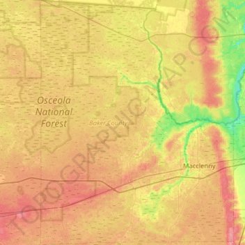
Name: Baker County topographic map, elevation, terrain.
Location: Baker County, Florida, United States of America (30.13645 -82.45979 30.58427 -82.04882)
Average elevation: 40 m
Minimum elevation: 10 m
Maximum elevation: 64 m
Other topographic maps
Click on a map to view its topography, its elevation and its terrain.
Seminole County
United States of America > Florida
Seminole County, Florida, United States of America
Average elevation: 14 m