
Cook County topographic map
Interactive map
Click on the map to display elevation.
About this map
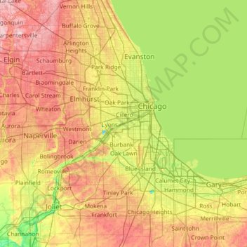
Name: Cook County topographic map, elevation, terrain.
Location: Cook County, Illinois, United States of America (41.46972 -88.26304 42.15447 -87.52333)
Average elevation: 197 m
Minimum elevation: 140 m
Maximum elevation: 288 m
Other topographic maps
Click on a map to view its topography, its elevation and its terrain.
Springfield
United States of America > Illinois > Springfield
Springfield, Sangamon County, Illinois, United States of America
Average elevation: 178 m
Boone County
United States of America > Illinois
Boone County, Illinois, United States of America
Average elevation: 260 m