
Orumba South topographic map
Interactive map
Click on the map to display elevation.
About this map
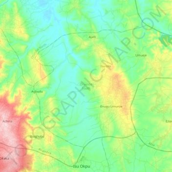
Name: Orumba South topographic map, elevation, terrain.
Location: Orumba South, Anambra State, Nigeria (5.92096 7.14629 6.05722 7.33906)
Average elevation: 142 m
Minimum elevation: 55 m
Maximum elevation: 341 m
Other topographic maps
Click on a map to view its topography, its elevation and its terrain.