
Otuocha topographic map
Interactive map
Click on the map to display elevation.
About this map
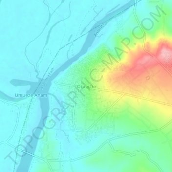
Name: Otuocha topographic map, elevation, terrain.
Location: Otuocha, Anambra East, Anambra State, Nigeria (6.31933 6.82692 6.35933 6.86692)
Average elevation: 43 m
Minimum elevation: 12 m
Maximum elevation: 147 m