
Seraikela Kharsawan topographic map
Interactive map
Click on the map to display elevation.
About this map
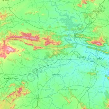
Name: Seraikela Kharsawan topographic map, elevation, terrain.
Location: Seraikela Kharsawan, Jharkhand, India (22.48528 85.51283 23.16115 86.24680)
Average elevation: 252 m
Minimum elevation: 115 m
Maximum elevation: 903 m
Other topographic maps
Click on a map to view its topography, its elevation and its terrain.