
Hudson County topographic map
Interactive map
Click on the map to display elevation.
About this map
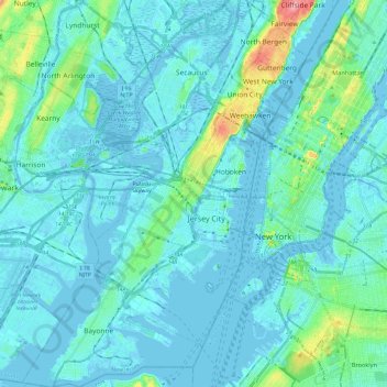
Name: Hudson County topographic map, elevation, terrain.
Location: Hudson County, New Jersey, United States of America (40.64215 -74.16609 40.82357 -73.98488)
Average elevation: 12 m
Minimum elevation: -9 m
Maximum elevation: 98 m