
London topographic map
Interactive map
Click on the map to display elevation.
About this map
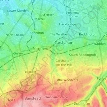
Name: London topographic map, elevation, terrain.
Average elevation: 71 m
Minimum elevation: 15 m
Maximum elevation: 173 m
Other topographic maps
Click on a map to view its topography, its elevation and its terrain.
Lewisham
United Kingdom > England > London > Lewisham
Lewisham, London, Greater London, England, SE13 6BB, United Kingdom
Average elevation: 28 m
Surrey
United Kingdom > England > London > Guildford
Surrey, Este Road, Clapham Junction, London Borough of Wandsworth, London, Greater London, England, SW11 2TB, United Kingdom
Average elevation: 69 m