
Kauaʻi County topographic map
Interactive map
Click on the map to display elevation.
About this map
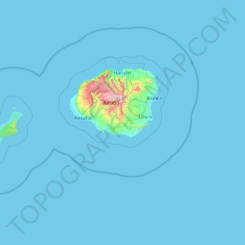
Name: Kauaʻi County topographic map, elevation, terrain.
Location: Kauaʻi County, Hawaii, United States of America (21.60038 -160.60017 22.29294 -159.24505)
Average elevation: 30 m
Minimum elevation: 0 m
Maximum elevation: 1,565 m
Other topographic maps
Click on a map to view its topography, its elevation and its terrain.
Hawaiʻi County
United States of America > Hawaii
Hawaiʻi County, Hawaii, United States of America
Average elevation: 476 m