
Sadang 2(i)-dong topographic map
Interactive map
Click on the map to display elevation.
About this map
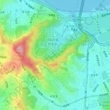
Name: Sadang 2(i)-dong topographic map, elevation, terrain.
Location: Sadang 2(i)-dong, Dongjak-gu, South Korea (37.48443 126.96214 37.50712 126.98524)
Average elevation: 48 m
Minimum elevation: 4 m
Maximum elevation: 163 m