Geolocate

Faro topographic map

Interactive map

Click on the map to display elevation.

About this map

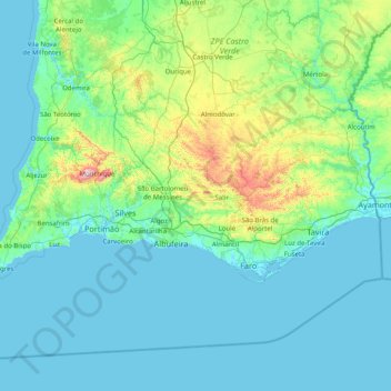
Name: Faro topographic map, elevation, terrain.

Location: Faro, Algarve, Portugal (36.96171 -8.99711 37.52913 -7.39330)

Average elevation: 99 m

Minimum elevation: -3 m

Maximum elevation: 884 m

Other topographic maps

Click on a map to view its topography, its elevation and its terrain.

Martim Longo

Portugal > Algarve > Martim Longo

Martim Longo, Alcoutim, Faro, Algarve, Portugal

Average elevation: 244 m

Monchique

Portugal > Algarve

Monchique, Faro, Algarve, Portugal

Average elevation: 204 m

São Bartolomeu de Messines

Portugal > Algarve > São Bartolomeu de Messines

São Bartolomeu de Messines, Silves, Faro, Algarve, Portugal

Average elevation: 170 m