
Ungongo topographic map
Interactive map
Click on the map to display elevation.
About this map
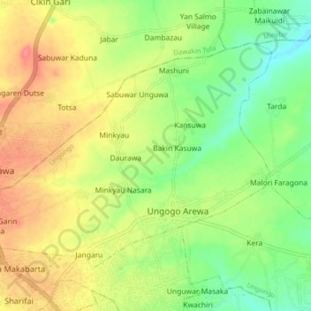
Name: Ungongo topographic map, elevation, terrain.
Location: Ungongo, Kano, Nigeria (12.07730 8.44044 12.13314 8.51905)
Average elevation: 484 m
Minimum elevation: 450 m
Maximum elevation: 521 m