
Iwajowa topographic map
Interactive map
Click on the map to display elevation.
About this map
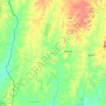
Name: Iwajowa topographic map, elevation, terrain.
Location: Iwajowa, Oyo, Nigeria (7.75061 2.67693 8.22830 3.38347)
Average elevation: 221 m
Minimum elevation: 110 m
Maximum elevation: 542 m
Other topographic maps
Click on a map to view its topography, its elevation and its terrain.