
Lusaka Province topographic map
Interactive map
Click on the map to display elevation.
About this map
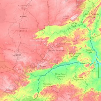
Name: Lusaka Province topographic map, elevation, terrain.
Location: Lusaka Province, Zambia (-15.96617 27.76978 -14.63842 30.42080)
Average elevation: 867 m
Minimum elevation: 325 m
Maximum elevation: 1,604 m