
Kayes topographic map
Interactive map
Click on the map to display elevation.
About this map
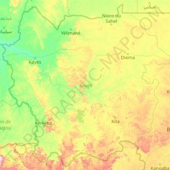
Name: Kayes topographic map, elevation, terrain.
Location: Kayes, Mali (11.89775 -12.24028 15.70279 -8.13200)
Average elevation: 261 m
Minimum elevation: 16 m
Maximum elevation: 1,480 m