
Magdalena Department topographic map
Interactive map
Click on the map to display elevation.
About this map
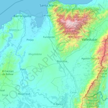
Name: Magdalena Department topographic map, elevation, terrain.
Location: Magdalena Department, Colombia (8.91711 -74.94559 11.34909 -73.54198)
Average elevation: 279 m
Minimum elevation: -2 m
Maximum elevation: 5,519 m