
Jambi topographic map
Interactive map
Click on the map to display elevation.
About this map
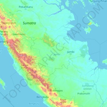
Name: Jambi topographic map, elevation, terrain.
Location: Jambi, Indonesia (-4.17157 100.21970 0.94843 105.33970)
Average elevation: 143 m
Minimum elevation: -3 m
Maximum elevation: 3,293 m