
Communauté urbaine de Nkongsamba topographic map
Interactive map
Click on the map to display elevation.
About this map
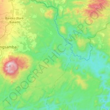
Name: Communauté urbaine de Nkongsamba topographic map, elevation, terrain.
Location: Communauté urbaine de Nkongsamba, Moungo, Littoral, Cameroon (4.83465 9.83067 5.02918 10.10490)
Average elevation: 605 m
Minimum elevation: 179 m
Maximum elevation: 1,793 m
Other topographic maps
Click on a map to view its topography, its elevation and its terrain.