
Karanganyar topographic map
Interactive map
Click on the map to display elevation.
About this map
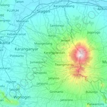
Name: Karanganyar topographic map, elevation, terrain.
Location: Karanganyar, Central Java, Indonesia (-7.78310 110.70836 -7.45610 111.19449)
Average elevation: 408 m
Minimum elevation: 63 m
Maximum elevation: 3,235 m