
Boyacá topographic map
Interactive map
Click on the map to display elevation.
About this map
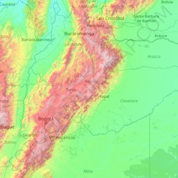
Name: Boyacá topographic map, elevation, terrain.
Location: Boyacá, Colombia (3.06790 -75.38686 8.18790 -70.26686)
Average elevation: 852 m
Minimum elevation: 28 m
Maximum elevation: 5,202 m
Other topographic maps
Click on a map to view its topography, its elevation and its terrain.