
Libya topographic map
Interactive map
Click on the map to display elevation.
About this map
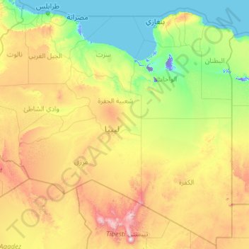
Name: Libya topographic map, elevation, terrain.
Location: Libya (19.49999 9.39108 33.35459 25.37706)
Average elevation: 424 m
Minimum elevation: -44 m
Maximum elevation: 3,239 m
Other topographic maps
Click on a map to view its topography, its elevation and its terrain.